GPS Tracks
and Topo's
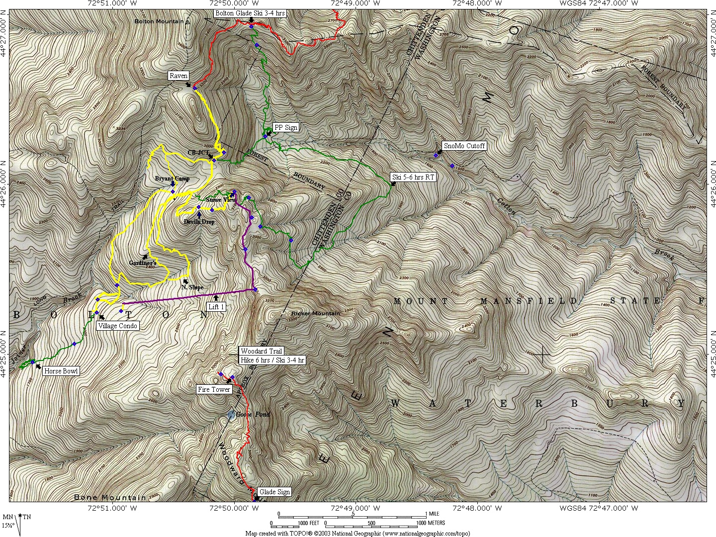
Choose a Bolton-Stowe Area
1a - Bolton Valley Nordic Trails GPS
1b - Little River State Park Trails
1c - Bolton Woodard Trails 10.13.03
1d - BoltonWoodardTrail6 10.13.03
1e - Bolton Valley Upper Joiner Falls-GPS_100420-02
1f - Bolton Valley Joiner Falls-GoogleMap_100420-03
1g - Bone Mnt and Goose_100817
1h - Bolton Valley Bone Mnt_081317
1i - Bolton/Trapp Cotton Brook/JK Trails
1j - Bolton / Cotton Brook Trails
1k - Bolton Cotton Brook Trails
1l - Bolton Cotton Brook Base Trails
1m - Bolton-Cotton Brook Trails_030704
1n - JohnBenitezBoltonTrapp_032605
1o - honey-hollow 21 Jan 2002
1p - Bolton Ski Trails
1q - Bolton Mnt Bike Trails
1r - Bolton To Trapp Trail
1s - BoltonTrappsTrailRiesAlt_02.15.04
1t - Bolton-Trapp
1u - Trapp Family Lodge Trails 17 Mar 2002
1v - Trapp Family Topo Tracks
1w - Trapp Family Lodge (West) + backcountry [USGS Bolton Mountain quad] 8 Jan 2002
1x - Trapp Family Lodge (East) + Topnotch + Rec Path [USGS Stowe quad] 8 Jan 2002
1y - Trapp Family Lodge Trails 17 Mar 2002
1z - Trapp Family Topo Tracks
1za - Trapp Family Lodge (West) + backcountry [USGS Bolton Mountain quad] 8 Jan 2002
1zb - Trapp Family Lodge (East) + Topnotch + Rec Path [USGS Stowe quad] 8 Jan 2002
2a - Stowe Mountain Resort + backcountry [USGS Mt. Mansfield quad] 8 Jan 2002
2b - Stowe John's Road 10/13/03
2c - edson-hill-large
2d - edson-hill-small
3a - Catamount Trail from Rte 2 to Bolton Touring Center 23 Jan 2002
3b - Catamount Trail Readsboro to Wilmington 2 Feb 2002
3c - Catamount Trail Wolcott to Craftsbury 1 23 Apr 2002
3d - Catamount Trail Wolcott to Craftsbury 2 23 Apr 2002
3e - Catamount Trail Natural Turnpike to Lincoln Gap 1 16 Feb 2002
3f - Catamount Trail Natural Turnpike to Lincoln Gap 2 16 Feb 2002
3g - Catamount Trail Jay Pass to Jay Village Trail 7 Apr 2002
4a - smr-mt-mansfield-quad
4b - smr-mt-mansfield-quad-medium
4c - smr-mt-mansfield-quad-small
4d - WestMansfieldTeardropW.b.Underhill_031404
4e - Backcountry trails on Skytop Ridge 2 Feb 2002
5a - CamelsHumpEthanAllenProfile_022104
5b - CamelsHumpSkidTrailsProfile_022104
5c - IraAllenSkidTrProfile02_021008
5d - Camels Hump Trail Map
5e - Camels Hump Burrows/Forest City Trails Map
5f - Camels Hump Topo Trail Map
5g - Camel's Hump Skier's Association Trail Map
6a - TuckermansRavineNH_041908
7a - BtvFlightFredMap_101403
7b - BtvFlightFredMap2_101403
Bolton-Stowe Areas
Choose a Kayak Area
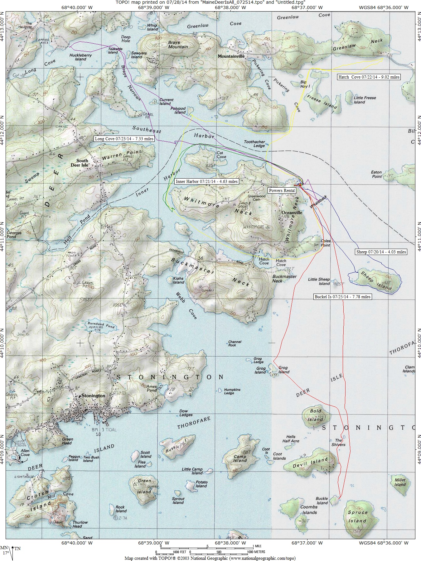
1 Deer Is - All 07.25.14
2 Deer Is - All 08.18.15
3 Deer Is -Buck Harbor 07.18.06
4 Deer Is -Grays Cove 07.20.06
5 Deer Is - Greys Cove 07.31.09
6 Deer Is - Holbrook 08.12.05
7 Deer Is - Naskeag 08.13.05
8 Deer Is - Naskeag 08.13.05
9 Deer Is - Inner Harbor 08.17.15
10 Deer Is - Long Cove 08.01.09
11 Deer Is - Long Cove 08.18.15
12 Deer Is - Mariners Park 08.11.05
13 Deer Is - Naskeag 07.29.09
14 Deer Is - Naskeag 08.13.05
15 Deer Is - Naskeag 2 08.13.05
16 Deer Is - Northwest Harbor 07.19.06
17 Deer Is - Sheep 08.16.15
18 Deer Is - Southwest Harbor 07.16.06
19 Deer Is - Stonington 07.17.06
20 Deer Is - Stonington 07.28.09
21 Deer Is - Stonington 08.20.15
22 Deer Is - Sheep Island
Btv Flight Fred Map 10.14.03
Btv Flight Fred Map 2 10.14.03
Maine - Deer Is Areas
Tug Hill Index
Choose an area
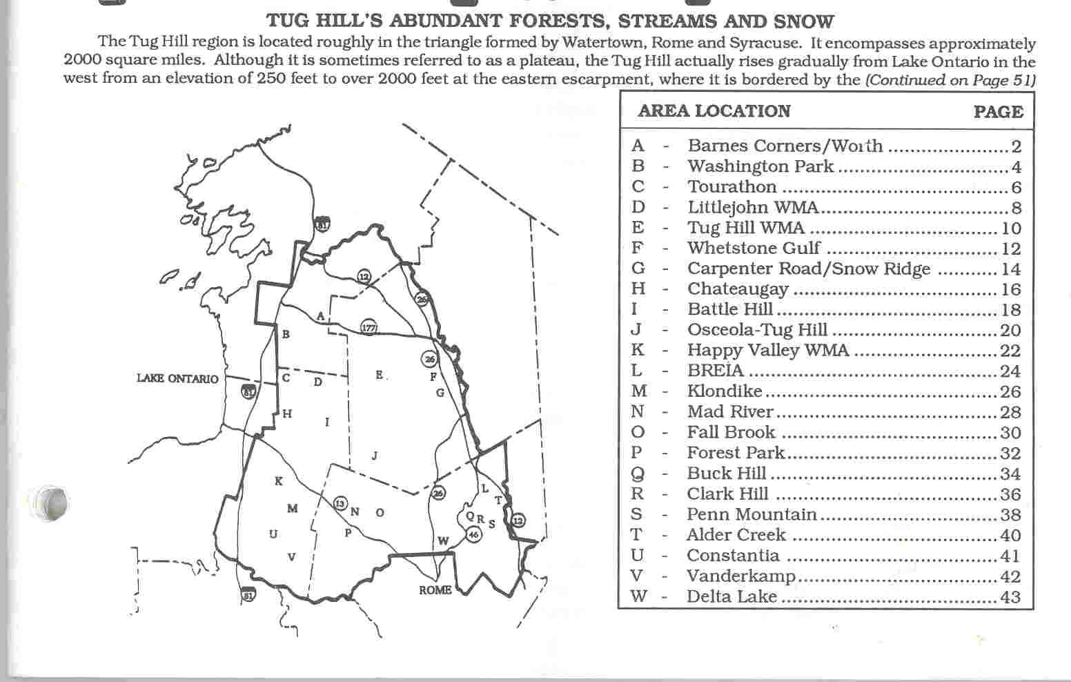
A - Barnes Corner
B - Washingotn Park
C - Tourathon
C - Winona Forest
C - Tourathon Trail Mileage and Directions
D - Little John
E - Tug Hill WIldlife Mng Area
F - Whetstone Gulf State Park
G - Carpenter Rd and Snow Ridge
H - Chateaugay State Forest
I - Battle Hill State Forest
J - Osceola-Tug Hill X-country Ski Center
K - Happy Valley Wildlife Man Area
L - BREIA
M - Klondike State Forest
N - Mad River State Forest
O - Fall Brook State Forest
P - Forest Park
Q - Buck Hill State Forest
R - Clark Hill State Forest
S - Penn Mountain State Forest
T - Alder Creek Golf Club
U - Constantia
V - Vanderkamp
W - Delta Lake State Park
X - Tour De Tug Bike Tour
Y - South Jefferson Heart Bike Tour
Z - Bike Centennial Iowa To Maine Bike Tour
Tug Hill Area
Description and Trail Maps